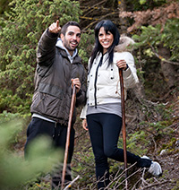
Hiking & Climbing
Helmos Mountain and, in fact, all of Achaia’s mountains are the ideal choice for fans of hiking, climbing, 4x4 trekking, motor-cross, and mountain sports in general.
Both hiking and climbing are activities that will reward hikers and climbers through the beauty of nature they will encounter. Those who are after tough climbs will have fun with the pleasant challenges along their climb.
If you are interested in hiking and/or climbing, please let us know in advance prior to your arrival: we will be happy to advise you as to what you should bring along to make your hiking and/or climbing experience a pleasant one.
Interested parties and especially those who are beginners are advised to take an experienced guide along, in groups of 2 to 10 persons for all trails. In those groups, the guide undertakes
responsibility for the appropriate equipment ensuring your safety, carries a first-aid kit, secures mountain guides and hiking sticks, and packs snacks if you wish.
Suggested hiking trails and climbing routes on Kalavryta’s Helmos Mountain:
Path: Kalavrita - Zachlorou
- Altitude: 700 to 600 meters
- Duration: 1 hour
- Difficulty: very easy route
- Description: a scenic route of awe-inspiring terrain within everyone’s walking ability
Path: Kalavrita-Kastro (Castle)-Vrahni
- Altitude: 800 to 950 meters
- Duration: 3 hours
- Difficulty: very easy route
- Description: the whole route moves along a dirt road which goes through a pine forest
Path: Xerokampos - Livadi tou Louka (Luke's Meadow)– Souvardo - Vrahni
- Altitude: 900 meters
- Duration: 4 hours
- Difficulty: easy route
- Description: for the most part, the route takes hikers on doable dirt road, flanked by fir trees and running streams where nature is at its best.
Path: Kalavrita-Diakofto
Path: Xerokampos - Lake Tsivlou
- Duration: 5 to 6 hours
- Difficulty: moderate route
- Description: most of the route is composed of trails. Only a small part of it follows an actual dirt road. The climbing incline is slight.
Path: Skepasto – Our Lady of Plataniotissa Shrine - Dormition of the Virgin Mary of Makellaria Monastery
- Elevation: 1,100m at Skepasto; 2,318m at Plataniotissa
- Duration: 7 hours
- Difficulty: moderate route
- Description: Starting at the regional department of Skepasto, Municipality of Kalavrita, the hike climbs to the Skepasto peak and reaches the village of Valta. From that point on, the route follows the road to reach the holy shrine of Our Lady of Plataniotissa. Continuing west, the route ends at the Makellaria Holy Monastery.
Path: Great Cave Monastery – Xerokampos - ‘Panos Polkas’ Helmos Ski Center
- Elevation: 500 to 1,100 meters
- Duration: 7 hours
- Difficulty: difficult route
- Description: For the first hour, hikers follow a hiking path. The next two hours are spent walking uphill to the mountaintop. The route ends during the fourth hour after a difficult climb. The dirt road of the route passes through forested land and has a slight upward incline.
Path: ‘Panos Polkas’ Helmos Ski Center - Mountain Shelter - Neraidorachi – Mavrolimni Psili Korfi -Waters of Styx
- Elevation: Shelter 2,100m - Neraidorachi 2,341m (difference in altitude: approx. 430m)
- Duration: 7 hours
- Difficulty: difficult path
- Description: The shortest way to Psili Korfi (High Peak) is through the Ski Center and along Vathia Lakka (deep pit). One and a half hours into the climb, hikers reach the Mountaineering Club shelter at Pouliou Vrysi (bird fountain). A further hour of climbing leads to the top of Neraidorachi. On their way back, moving towards Aetorachi and Psili Korfi, hikers go past Neraidalono. The route’s downhill part heads towards Mavrolimni and then on to the Waters of Styx.
Path: Peristera (Solos) - Waters of Styx
- Altitude: starts at 1,000 meters
- Duration: 4½ hours
- Difficulty: a difficult route recommended for snow-free times of the year
Description: The hike starts at the village of Peristera (Solos). Hikers are in for the rare treat of Lake Tsivlou’s breathtaking vistas (700m) nestled within a forest, a few kilometres before the village of Peristera. The route follows a road through a pine forest and continues onto a path leading to the lower part of the Waters of Styx waterfalls.

