Activities
Mountain biking
 |
NATOUR in cooperation with the Hellenic Society for the Protection of Nature (EEPF), have developed the network of hotels and tourist destinations that are friendly to tourists-cyclists.
Our hotel has been integrated into this network and has received the special "Bike Friendly" brand, fulfilling a range of internationally recognized criteria (hotel criteria - criteria for tourist destinations).
You and your friends can organize many and versatile excursions on your mountain bikes following paths and forest tracks of the National Park of Chelmos – Vouraikos.
Experienced guides, with full knowledge of the special paths and the area, can organize the appropriate excursion for you based on your desires and capabilities.
The safety specifications, donning a helmet and appropriate protective accessories, are strictly observed in the organized excursions. The participants in these mountain-bike excursions are covered by civil liability insurance, and are provided with suitable bikes, maps and guides for the activity.
Your excursion should ideally have been organized 2 days prior to your arrival in Kalavryta.
You can choose one of the following proposed itineraries for your excursion.
Itinerary 1 Kalavryta - Agia Lavra - Kalavryta
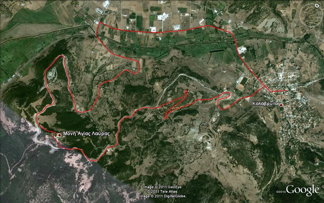
MAP: Kalavryta – Monastery of Agia Lavra
Distance: 14200 meters
Altitude range: 270 meters
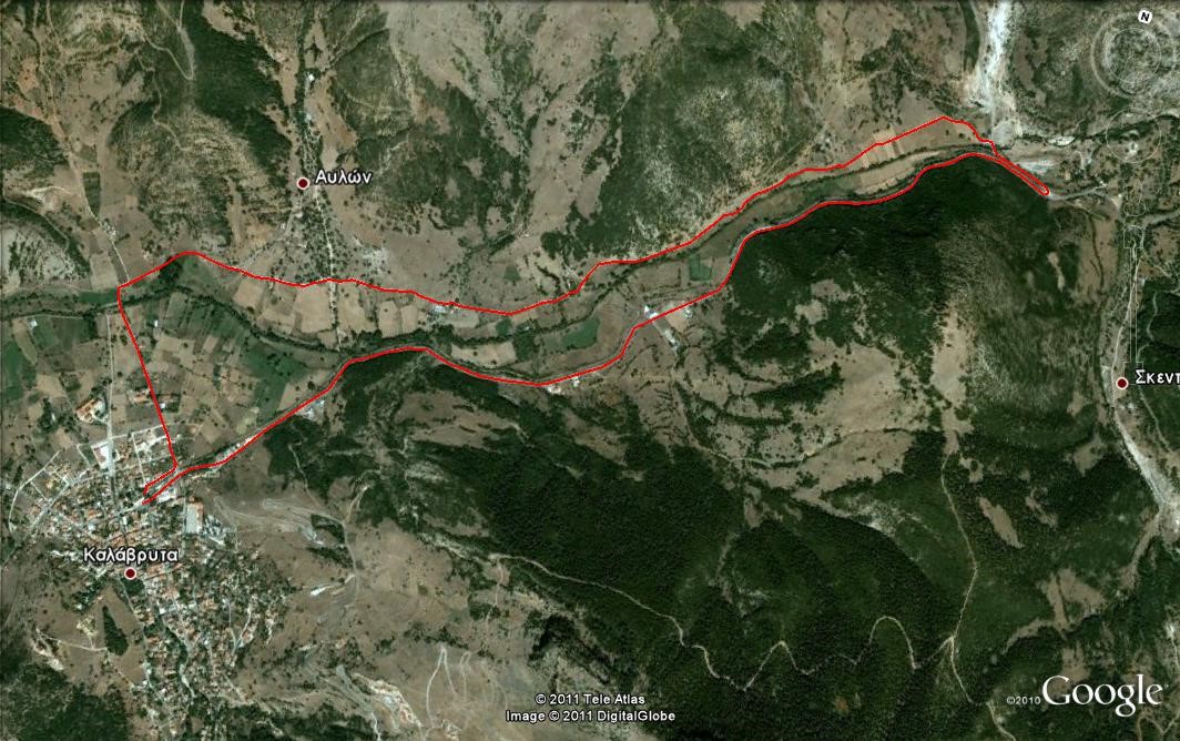
Itinerary 2 Foot of the castle - Skendjaika - Kalavryta
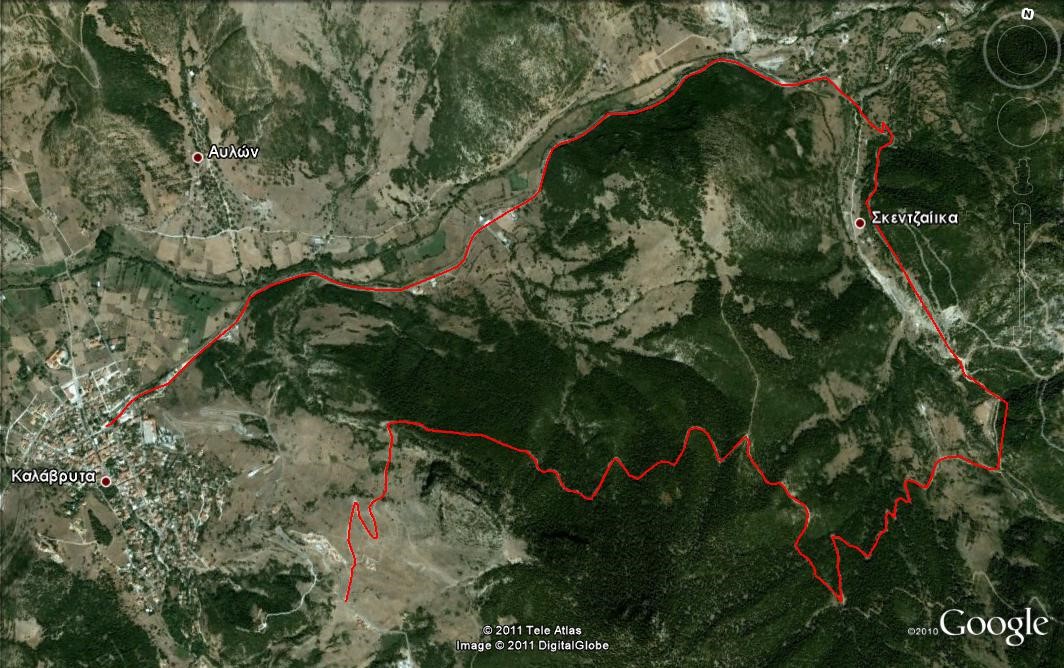
MAP: Kalavryta – Skentzaiika - Avlon
Distance: 12000 meters
Altitude range: 320 meters
Itinerary 3 Kalavryta – Mega Spileo – Kalavryta
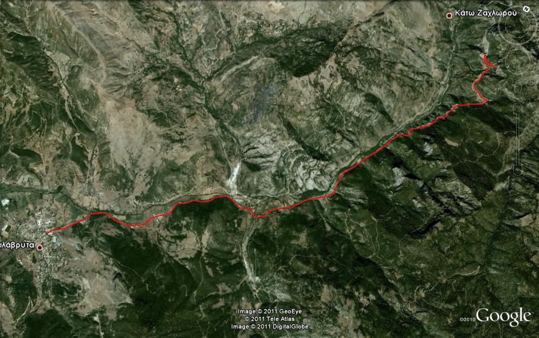
MAP: Kalavryta – Kato Zahlorou
Distance: 21000 meters
Altitude range: 300 meters
Itinerary 4 Kalavryta – Kerpini stop – Kalavryta
MAP: Kalavryta – Avlon - Skentzaiika
Distance: 8600 meters
Altitude range: 40 meters
Itinerary 5 Ski center – Souvardo – Skentzaiika – Kalavryta
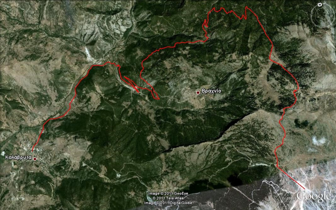
MAP: Kalavryta – Vrahnio
Distance: 21000 meters
Altitude range: 1000 meters
Itinerary 6 Kalavryta – Kertezi intersection – Kalavryta
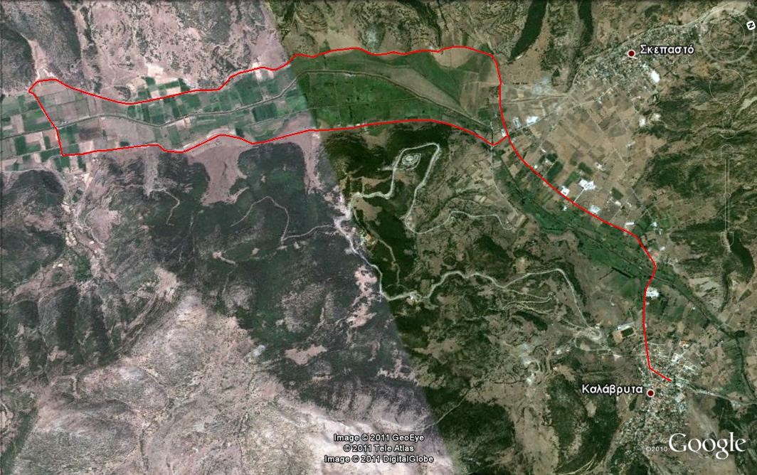
MAP: Kalavryta – Skepasto
Distance: 18200 meters
Altitude range: 30 meters
Itinerary 7 Kalavryta - mines - Kalavryta
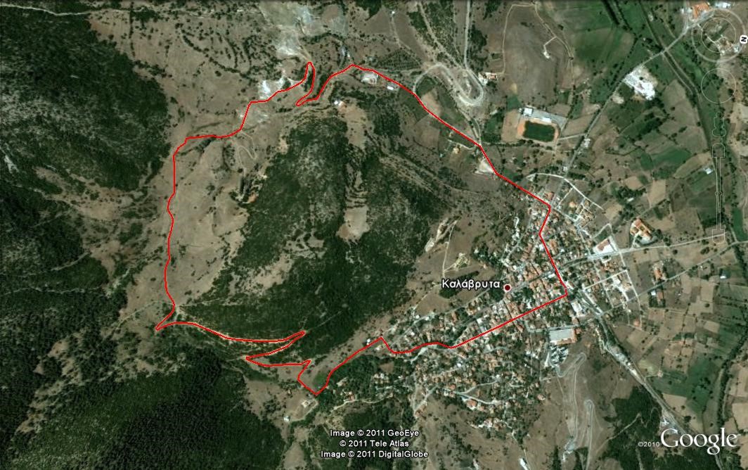
MAP: Kalavryta
Distance: 6000 meters
Altitude range: 250 meters
awards